Oxide Peak

Overview

The 8,437-hectare Oxide Peak project is situated in the northern part of the Toodoggone gold-copper district, a region of extensive Early Jurassic porphyry copper-gold and epithermal gold-silver mineralization, including several past-producing Au-Ag mines (Baker, Lawyers, Shasta) and the large Kemess South Au-Cu porphyry deposit. Historical production in the district exceeds 3.2 million ounces of gold and 360,000 tonnes of copper. The property adjoins ground currently being explored for porphyry copper-gold by Freeport McMoRan.

Oxide Peak is contiguous to the north of TDG’s 100 % owned former producing Baker-Shasta gold-silver project (Figure 1). The project was added to TDG’s portfolio of Toodoggone assets in 2019 (see TDG news release December 23, 2019) through an option and joint venture agreement signed with ArcWest Exploration Inc. Completion of the proposed exploration activities in 2022 will result in TDG achieving 60 % ownership of Oxide Peak. Oxide Peak has a valid work authorization (three-year Multi-Year Area Based) Notice of Work (“NoW”) and is fully permitted for TDG’s proposed 2022 exploration activities.

Looking North Across Oxide Peak

Property Geology & Survey Work

In 2020, TDG completed an airborne magnetic survey over the Oxide Peak property consisting of two survey blocks, which provide 84 square kilometres (“km”) of coverage at 100 metre (“m”) line spacing. Ground survey work was also completed, including soil geochemistry and a ground Induced Polarization (“IP”) survey. During the 2021 exploration season, TDG completed airborne geophysics, Light Detection and Ranging (“LiDAR”) / Orthophoto and small-scale geological mapping focused on the Drybrough target area (“Drybrough”) located adjacent to Baker and leading to 1,029 m of diamond drilling at Drybrough completed in December 2021.

Oxide Creek – 2022 Target #1

Oxide Creek is a porphyry-style target located at the northern portion of the Oxide Peak mineral tenure. The target appears to be hosted by a multiphase intrusion, which cores an extensive zone of quartz-sericite-pyrite (“QSP”) and advanced argillic alteration. Magmatic-hydrothermal breccias with quartz-magnatite-chalcopyrite veins and relict potassic alteration outcrop at Oxide Creek. A potassic altered copper-gold (“Cu-Au”) mineralized centre may exist at relatively shallow depths with the potential for Cu-Au grades to improve with depth and potassium alteration intensity.  The target has been identified by coincident soil geochemistry, alteration/geological mapping and geophysical expression (Figures 2 & 3). A detailed high-resolution ground magnetic survey is planned as an initial follow-up on 50 m spaced survey lines (Figure 4), which will aid in refining the final drill target location, to be executed in 2022. Oxide Creek has never been drill tested, to date.

Figure 5. Oxide Peak Property – Drybrough 2021 Drillhole Locations.

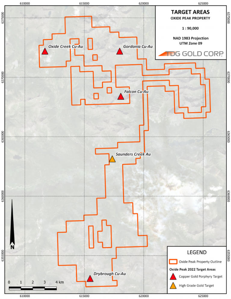
Drybrough – 2022 Target #2 

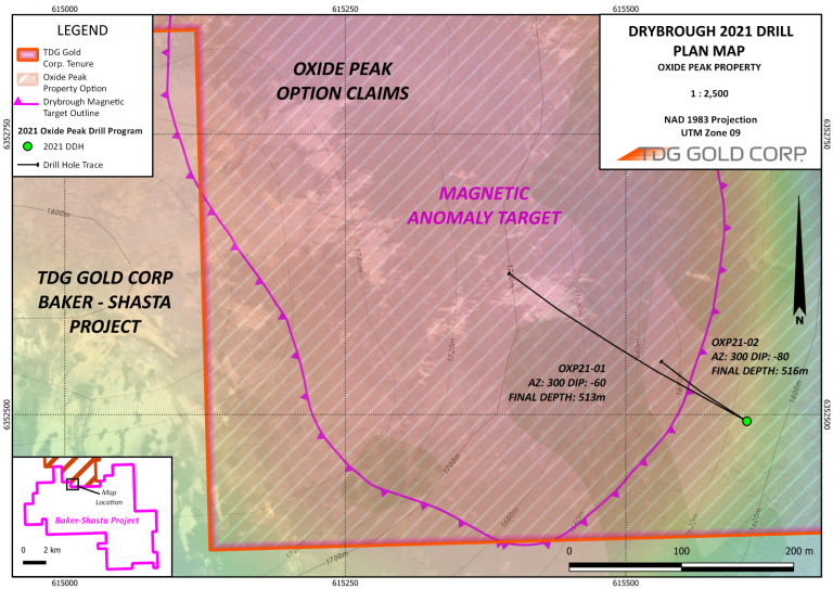
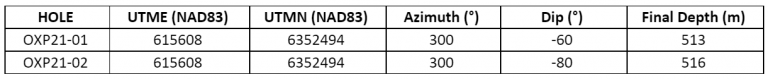
The Drybrough porphyry copper (“Cu”) and gold (“Au”) target is a conceptual geophysical target identified in 2021 centered on a magnetic high about 1 km across (see TDG News Release, November 16, 2021). This magnetic feature is flanked by surface gossans originally mapped by Dupont Canada in the 1980s. Two drillholes were completed during the 2021 field season at Drybrough, for a total of 1,029 m drilled (Figure 5 & Table 1). Both drillholes intersected a sequence of volcanic and volcaniclastic rocks (ash tuff, crystal tuffs and lithic tuffs) intercalated with fine sedimentary horizons. Alteration was generally quartz-chlorite, with localized zones of variable intensity hematite and potassic alteration. Fine-grained pyrite was ubiquitous through the drill intersections with trace quartz-carbonate veins/veinlets containing increased pyrite concentrations. Both drillholes intersected anomalous silver (“Ag”), which increased with depth along with certain pathfinder elements. OXP21-01 (-60°) intersected 4.11 grams/tonne (“g/t”) Ag over 3.36 m at the end of the drillhole (510 m downhole depth) in coarse-grained sericite-chlorite altered lithic tuff with up to 10 % pyrite, increasing downhole in an interval of increasing small gouge filled faults. 

Full multi-element analysis was undertaken on the drill core assays, which TDG is continuing to review as part of targeting for the next phase of drilling at Oxide Peak in 2022. 

Table 1. 2021 Oxide Peak Drillhole Particulars.
Figure 6. Oxide Peak Property – 2022 Target Areas.

Additional Target Areas 

Multiple additional Cu-Au exploration targets exist throughout the property (Figure 6), all of which are untested by diamond drilling. These include large, variably Cu-Au mineralized gossans at the Gordonia, Falcon and Saunders Creek, where grab samples have returned assays from below detection limit to up to 46.1 g/t Au. Stream sediment samples collected from the Saunders target area have returned assays from below detection limit to in excess of 10,000 parts per billion (“ppb”) Au. This Au anomaly has yet to be traced to source, and will be a high priority follow up area in 2022.